
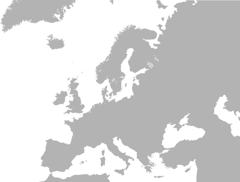
Файл:Blank map europe no borders.svg

ХӀокху PNG-превью барам, SVG-файлан: 792 × 600 пиксель. Кхин шоралла: 317 × 240 пиксель | 634 × 480 пиксель | 1015 × 768 пиксель | 1280 × 969 пиксель | 2560 × 1938 пиксель | 10 495 × 7945 пиксель.
Оригиналан файл (SVG-файл, лартӀахь йу 10 495 × 7945 пиксель, файлан барам: 302 Кб)
Vjhhj
Файлах лаьцна
| Цуьнах лаьцна |
|
| Терахь | (UTC) |
| Хьост | Derived from Blank_map_europe.svg |
| Автор | derivative work: cthuljew |
| Кхин версеш | Derivative works of this file: Brittany ferries route map.svg |
| Это отретушированное изображение, что означает, что первоначальной версия изображения была изменена цифровым способом. Изменения: Removed borders for more general use.. Оригинал доступен по ссылке: Blank map europe.svg:
|
| Аса, хӀокху произведенин авторийн бакъо йолучу, иза йукъараллин рицкъан дӀало. ХӀара бакъо лелаш йу дуьнена массо меттигехь. Цхьайолу пачхьалкхашкахь юридически магийна дац, иштта делахь: Аса массарна а бакъо ло хӀара произведени шайна луург деш лело цхьаа тӀедиллина хӀума а доцуш, Ӏедало де бохург дичахьана. |
Чуйахаран дӀадолалун тептар
This image is a derivative work of the following images:
- File:Blank_map_europe.svg licensed with PD-USGov-CIA-WF
- 2008-10-26T21:20:07Z Cradel 680x520 (533055 Bytes) there is another version of this image
- 2008-10-26T17:25:49Z Avala 680x520 (528468 Bytes) didn't we agree to have alternative files that include disputed territories? this way it is POV, who decides which one deserves to be shown as a country more, Kosovo, Palestine, TRNC, Abkhazia etc.
- 2008-10-25T13:36:13Z Cradel 680x520 (533055 Bytes) what ?
- 2008-10-24T22:42:12Z Avala 680x520 (528468 Bytes) '
- 2008-09-22T13:35:30Z Cradel 680x520 (533055 Bytes) user has been warned
- 2008-09-22T02:11:46Z Tocino 680x520 (528468 Bytes) Reverted to version as of 17:38, 19 September 2008
- 2008-09-20T11:36:04Z Cradel 680x520 (533055 Bytes) Reverted to version as of 18:23, 17 September 2008
- 2008-09-19T17:38:55Z Tocino 680x520 (528468 Bytes) Reverted to version as of 18:12, 17 September 2008
- 2008-09-17T18:23:13Z Cradel 680x520 (533055 Bytes) look at the "other versions" section
- 2008-09-17T18:12:42Z Tocino 680x520 (528468 Bytes) Kosovo is not internationally recognized and this map is used for more than just CIA purposes
- 2008-09-16T16:01:06Z Cradel 680x520 (533055 Bytes) CIA recognises Kosovo, this is their map, do not vandalise it
- 2008-09-16T15:39:16Z Tocino 680x520 (528468 Bytes) Reverted to version as of 00:01, 16 September 2008
- 2008-09-16T10:07:44Z Cradel 680x520 (533055 Bytes) it is a god dammed CIA map
- 2008-09-16T00:01:36Z Tocino 680x520 (528468 Bytes) Reverted to version as of 17:23, 15 September 2008
- 2008-09-15T20:44:48Z Cradel 680x520 (533055 Bytes) Reverted to version as of 19:15, 14 September 2008
- 2008-09-15T17:23:28Z Tocino 680x520 (528468 Bytes) Reverted to version as of 17:03, 14 September 2008
- 2008-09-14T19:15:53Z Cradel 680x520 (533055 Bytes) sigh, please look her : https://www.cia.gov/library/publications/the-world-factbook/geos/kv.html
- 2008-09-14T17:03:29Z Milosevo 680x520 (528468 Bytes) Reverted to version as of 14:45, 13 September 2008 CIA recognizes cosovo? What? And tomorrow ROSKOSMOS recognizes covoso ..
- 2008-09-13T18:08:41Z Cradel 680x520 (533055 Bytes) fix
- 2008-09-13T18:01:06Z Cradel 680x520 (530422 Bytes) this is CIA map, which recognises kosovo
- 2008-09-13T14:45:29Z Avala 680x520 (528468 Bytes) '
- 2008-08-06T20:03:48Z Cradel 680x520 (530422 Bytes) Reverted to version as of 16:17, 4 August 2008
- 2008-08-05T04:35:29Z Rokerismoravee 680x520 (528468 Bytes) Reverted to version as of 14:46, 4 August 2008
- 2008-08-04T16:17:13Z Cradel 680x520 (530422 Bytes) Reverted to version as of 12:09, 3 August 2008
- 2008-08-04T14:46:55Z Rokerismoravee 680x520 (528468 Bytes) Reverted to version as of 13:14, 2 August 2008
- 2008-08-03T12:09:59Z Cradel 680x520 (530422 Bytes) again : what are you talking about
- 2008-08-02T13:14:48Z Milosevo 680x520 (528468 Bytes) Territory of Kosovo isn't correct
- 2008-08-02T12:48:39Z Cradel 680x520 (530422 Bytes) this map was taken from the CIA world Factbook, which recognises Kosovo so please
- 2008-08-01T21:28:39Z Rokerismoravee 680x520 (528468 Bytes) Reverted to version as of 12:54, 1 August 2008
- 2008-08-01T19:07:24Z Cradel 680x520 (530422 Bytes) Reverted to version as of 20:44, 9 June 2008
- 2008-08-01T12:54:32Z Rokerismoravee 680x520 (528468 Bytes) Reverted to version as of 17:34, 9 June 2008
- 2008-06-09T20:44:17Z Cradel 680x520 (530422 Bytes) Reverted to version as of 17:01, 9 June 2008
- 2008-06-09T17:34:51Z Milosevo 680x520 (528468 Bytes) Reverted to version as of 14:14, 9 June 2008
- 2008-06-09T17:01:41Z Cradel 680x520 (530422 Bytes) Reverted to version as of 20:14, 8 June 2008
- 2008-06-09T14:14:04Z Milosevo 680x520 (528468 Bytes) revert, vandalism. No UN-Member
- 2008-06-08T20:14:58Z Cradel 680x520 (530422 Bytes) Reverted vandalism
- 2008-06-08T15:21:43Z Milosevo 680x520 (528468 Bytes) Reverted to version as of 21:10, 27 May 2007
- 2008-05-30T12:01:01Z Cradel 680x520 (530422 Bytes) + Kosovo
- 2007-05-27T21:10:55Z Ssolbergj 680x520 (528468 Bytes) '
- 2006-08-06T14:15:12Z Estoy Aquí 1200x1000 (318304 Bytes) * Description: Blank map of Europe * Source: SVG trace of PNG of the same name. Original PNG based on CIA map[https://www.cia.gov/cia/publications/factbook/index.html The World Factbook] * Author: PNG author [[User:San Jose|S
Uploaded with derivativeFX
Файлан истори
Тlетаlаде терахь/хан, муха хилла хьажарна и файл.
| Терахь/Хан | Жима | Файлан барам | Декъашхо | Билгалдаккхар | |
|---|---|---|---|---|---|
| карара | 2009, 28 январь, 19:52 | | 10 495 × 7945 (302 Кб) | Phirosiberia | Only one object. |
| 2009, 22 январь, 00:17 |  | 680 × 520 (316 Кб) | Cthuljew | {{Information |Description=* Description: Blank map of Europe * Source: Modification of SVG trace of PNG of the same name. Original PNG based on CIA map [https://www.cia.gov/cia/publications/factbook/index.html The World Fa |
Файл лелор
ХӀара файл агӀонашкахь лелош йац.
Глобалан файл лелор
ХӀара файл лелош йу лахахь гайтина йолу википедеш чохь:
- Лелор en.wikipedia.org
- Лелор ia.wikipedia.org